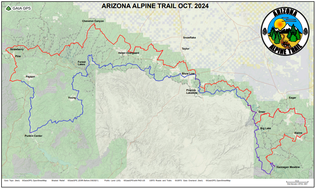
The total mileage for all trails that will link the above cities together will be approximately 700 miles. As links are created that connect main trails to points of interest, the total mileage will increase. The final project will be to create trails that provide a fun trip from any of the cities listed above. The development of the multi trail system is a lengthy process involving many different partners: cities, counties, government agencies, etc. Bringing all the different interested parties together and reaching necessary agreements takes time. Many of the proposed trail routes are currently being used by different OHV groups. Before the trails can become accepted as “official”, many agreements must be reached. Meetings with the interested parties are occurring on a monthly basis.
